Hello Fireshed Members,
Things are heating up in the Southwest. This last week was a big one for wildfire starts across New Mexico, and with that in mind, we have compiled some helpful resources for you to stay informed and active in conversations about your community’s wildfire hazard.
As fire season progresses, it is never too late to do some simple mitigation work around your house and we encourage you all to look back at some of our early posts for some simple ways that you can get involved.
This week’s Wildfire Wednesday includes:
A 2020 fire season update and nmfireinfo.com and inciweb.nwcg.gov where you can get up-to-date information about active wildfires across the state.
A webinar recording about how to use the new Wildfire Risk to Communities online map viewer.
A call for presenters and save-the-date for the Wildland Urban Fire Summit this fall in Las Vegas, New Mexico.
Stay safe,
Gabe
Fire Season Heats Up
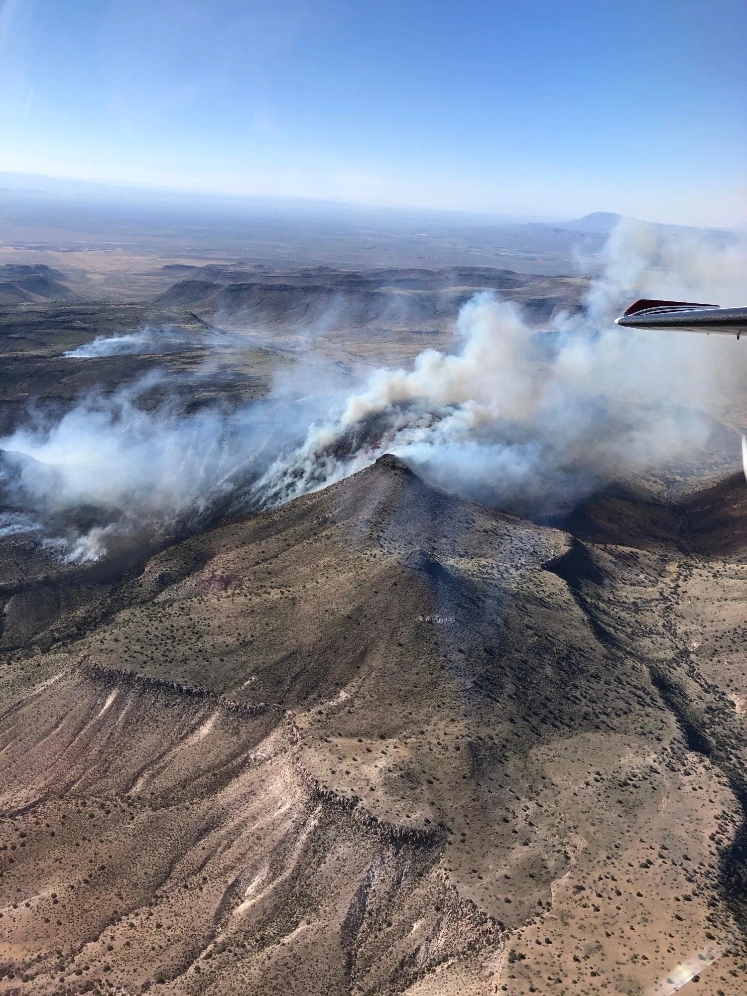
Uvas Fire- This photo was taken on Jun 7th of the ~1000 acre Uvas fire near Las Cruces. Photo from Inciweb.
We had 6 active wildfires reported over last weekend (6/5-6/7) and a couple early this week. As fire season heats up, you must know where to find accurate and up-to-date information about the wildfires that are occurring across the state.
The best place to find information about active wildfires across New Mexico is NMFireInfo.com . This website is an interagency effort by the State of New Mexico, National Park Service, Fish and Wildlife Service, Bureau of Indian Affairs, Forest Service, and Bureau of Land Management to keep New Mexican's informed about current significant wildfires, fire restrictions, and helpful links to wildfire prevention information. Click on the +Follow tab in the lower right corner of NMFireInfo.com to sign up to get an e-mail when new NMFireInfo.com posts are added.
Once an incident transitions from a new start to a larger fire that needs long-term management they are added to Inciweb. This interagency website provides the public with a single source of incident-related information and provides in-depth information such as maps, photos, and an archive of press releases. Click here to visit InciWeb
Wildfire Risk to Communities Webinar
Previously on the blog, we announced the new Wildfire Risk to Communities Viewer created by the US Forest Service and partners. Now you can view a recording of the webinar in which the creators of the website and the fire risk analysis explain how to use the new tool and all of its functions.
https://www.youtube.com/watch?v=ivWol9_NEMs&feature=youtu.be
Wildfire Risk to Communities is a new free, easy-to-use website with interactive maps, charts, and resources to help communities understand, explore, and reduce wildfire risk. This website serves as a starting point to help community leaders be able to assess and reduce risk to homes, businesses, and other valued resources. Use this website to start conversations with neighbors, family members, and anyone else in your community about wildfire.
Call for Presenters for 2020 Wildland Urban Fire Summit (WUFS)
This year’s Wildland Urban Fire Summit will center around the theme, “All Lands, All Neighbors for Wildfire Resilience.” As a diverse network that bridges between agency officials, non-governmental organizations, private landowners, and many others, your work as a Fireshed Member is well-suited to this year’s summit theme. We hope you will all take a look at the attached Call for Presentations and consider sharing some of the wildfire adaptation work you are doing in your community.
Presentation ideas need to be submitted by July 31st, 2020 and the Summit is planned for October 22-23, 2020. Please save these dates.
To read the full Call for Presentations, click here.


