Wildfire Wednesdays #71: Community Wildfire Protection Plans

Happy Wednesday fireshed community!

We hope you’re enjoying fall and are excited to safely celebrate Halloween this weekend! Many prescribed burns are occurring throughout the state this month, check out NM Fire Info to stay informed and read our previous blog post on prescribed fires to learn more on why these burns are important. This week we’re sharing information on Community Wildfire Protection Plans (CWPPs) which are an important tool in protecting communities from wildfire risk and damage.

This week’s Wildfire Wednesday features information on:

  • What is a Community Wildfire Protection Plan (CWPP)?

  • New Mexico CWPPs

  • An active forest management success story: 2020 Medio Fire

  • Rural Voices for Conservation Coalition’s “Fighting Fire with Fire: Policy Options to Increase the Use of Prescribed Fire on National Forests”

  • Coyote Creek prescribed fire announcement


What is a Community Wildfire Protection Plan (CWPP)?

From the National Wildfire Coordinating Group:

“A plan developed in the collaborative framework established by the Wildland Fire Leadership Council and agreed to by state, tribal, and local government, local fire department, other stakeholders and federal land management agencies managing land in the vicinity of the planning area. A Community Wildfire Protection Plan (CWPP) identifies and prioritizes areas for hazardous fuel reduction treatments and recommends the types and methods of treatment on Federal and non-Federal land that will protect one or more at-risk communities and essential infrastructure and recommends measures to reduce structural ignitability throughout the at-risk community. A CWPP may address issues such as wildfire response, hazard mitigation, community preparedness, or structure protection - or all of the above.”

source: NM EMNRD

From the New Mexico Energy, Minerals and Natural Resources Department (EMNRD):

Community Wildfire Protection Plans have 3 primary components:

  1. Collaboration with all stakeholders throughout the CWPP process,

  2. Identification and prioritization of hazardous fuel reduction areas, and

  3. Addressing the treatment of structural ignitability within the CWPP area.

A CWPP should identify areas that need vegetative fuels removed to reduce wildfire risk and severity, suggest methods to reduce structural ignitability, and evaluate a community’s firefighting capacity. This planning process helps unite communities by identifying their risk to wildfire, their community values, and their critical infrastructure. Factored together, these concerns should produce a prioritized list of vulnerable areas to be treated, as well as the potential treatment options.
— 2020 Communities at Risk Assessment Plan (NM EMNRD)

New Mexico CWPPs

All of the counties in New Mexico either have a complete CWPP in place or are in progress of developing a complete CWPP. CWPPs in New Mexico must be approved by the Fire Planning Task Force which consists of “of local, state, federal, and tribal cooperators who assist Forestry to identify and protect areas most vulnerable to wildfires.” CWPPs are reviewed by the 1st of December each year so keep an eye out for updated CWPPs coming out soon!


An active forest management success story: 2020 Medio Fire

“The Medio Fire was a lightning-caused fire reported on August 17, 2020, on the Española Ranger District of the Santa Fe National Forest in New Mexico. During the first couple days, the Medio Fire made significant sustained runs as a high-intensity crown fire. These runs resulted in 16% high-severity burn within the total burned area. But thanks to pre-fire treatments that mitigated fire behavior, 49% of the fire burned at low severity. The 4,010-acre Medio Fire was managed with a suppression strategy, consistent with national USFS policy during the 2020 wildfire season. The 2019 Pacheco Rx (a prescribed fire) and fuel break thinning treatments played the biggest role in reducing fire intensities and preventing further fire progression to the south and east. Two large scale collaborative projects led to the treatments that mitigated fire behavior. These projects encompass all three of the priorities laid out by the National Cohesive Wildland Fire Strategy: 1) landscape resilience, 2) fire adapted communities, and 3) safe and effective fire response.”


Rural Voices for Conservation Coalition’s “Fighting Fire with Fire: Policy Options to Increase the Use of Prescribed Fire on National Forests”

“This report provides an overview of the current science and need for prescribed fire, describes barriers to the use of prescribed fire on public lands in the western U.S. managed by the Forest Service, and described policy options to overcome these barriers… prescribed fire is unique in serving to both reduce the risks associated with wildfire and to help restore ecological function in natural systems.”

Coyote Creek Prescribed Fire Announcement!

Wildfire Wednesdays #70: Understanding Wildfire Risk

Hi Fireshed Community,

As the weather begins to change, it is a great time to take action by educating ourselves and our friends, family, and neighbors about wildfire risk. This week’s Wildfire Wednesdays newsletter shares some great opportunities for you to learn more about the relationship between New Mexico’s landscapes and wildfire.

This Week’s Wildfire Wednesdays features:

  • Join the public meeting tomorrow (10/14) about the Santa Fe Mountains Landscape Resiliency Project

  • Take a look at the Wildfire Risk to Communities tool to better understand the wildfire risk in your area.

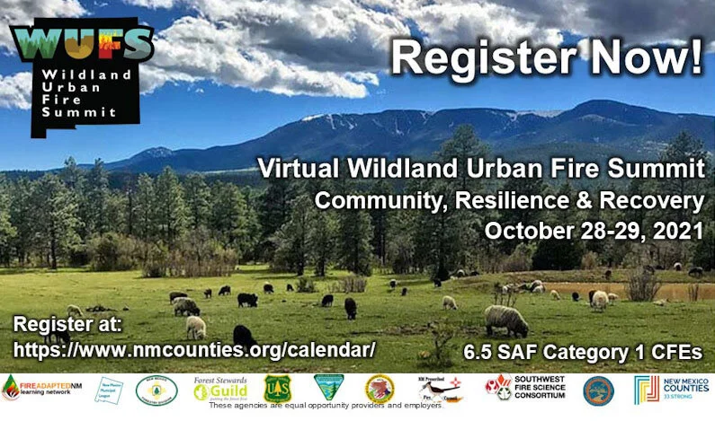
  • Register now for the 2021 virtual Wildland Urban Fire Summit

Best,

Gabe

Public Meeting (10/14) - Santa Fe Mountains Landscape Resiliency Project

The previously announced virtual open house on the Santa Fe Mountains Landscape Resiliency Project (SFMLRP) this Thursday will livestream on Zoom, not Facebook, which will give members of the public the opportunity to speak directly with specialists who worked on the proposal.

The SFMLRP “lunch and learn” is scheduled for Oct. 14 from 12 to 1:30 p.m. The Zoom link is https://us02web.zoom.us/j/81896951009. Participants may also call into the meeting by dialing 346- 248-7799 and entering the meeting ID 818 9695 1009.

Hosted by the Santa Fe National Forest and the Greater Santa Fe Fireshed Coalition (GSFFC), the lunch and learn will begin with a brief overview of the project and then break into three virtual “rooms.” Specialists will spend 20 minutes in each breakout room to give participants an opportunity to have a conversation with them on vegetation, fire and fuels, air quality and climate, wildlife, scenery and recreation will be available.

The proposed project is designed to improve the health of a priority landscape and increase its resilience to future disturbances, including wildfire, climate change, insects and disease, by using prescribed fire and small-tree thinning on up to 38,680 acres across a 50,566-acre project area over the next 10 to 15 years. The SFMLRP was developed by the GSFFC, a multi-partner collaborative that came together to proactively address the risk of high-severity wildfire and post-fire flooding and debris flow near the city of Santa Fe.

The 30-day public comment period on the draft environmental assessment (EA) opened on Sept. 30, and comments received by Oct. 29 will be analyzed and responded to prior to a decision on the SFMLRP. Substantive comments received during this period will also establish standing to raise an administrative objection later in the decision-making process. Comments on the SFMLRP draft EA can be submitted by one of the following methods:

• CARA (Comment and Analysis Response Application) web form which is accessible from the project webpage by clicking “Comment/Object on Project”

• Email to comments-southwestern-santafe@fs.fed.us

• Regular postal mail to Española District Office, 18537 US 84/285, Suite B, Española, NM 87532

Wildfire Risk to Communities

To explore this interactive tool and better understand your wildfire risk, click here.

“Wildfire Risk to Communities is a free, easy-to-use website with interactive maps, charts, and resources to help communities understand, explore, and reduce wildfire risk. It was created by the USDA Forest Service under the direction of Congress and is designed to help community leaders, such as elected officials, community planners, and fire managers. This is the first time wildfire risk to communities has been mapped nationwide.”


Register now for the 2021 virtual Wildland Urban Fire Summit

Click the play button on the video above to hear from members of our planning committee about the 2021 summit!

Register NOW for the 2021 New Mexico Wildland Urban Fire Summit! The event takes place on October 28th and 29th from 9am-1pm MST.

This years theme is Community, Resilience & Recovery 

The Wildland Urban Fire Summit (WUFS) is one of New Mexico’s leading events for wildfire preparedness and planning. Join your peers, community leaders, fire service professionals, and federal, state, tribal, and local governments for this FREE virtual summit. Learn from communities adapting to a wildfire environment about the latest techniques, strategies, and resources for wildfire adaptation and resilience. Expand your network of peers and experts to assist you in your fire/disaster resiliency goals.

Click HERE for more information about the 2-day agenda and list of summit speakers.


Public Meeting: the Santa Fe Mountains Landscape Resiliency Project, Tonight (10/6), 6pm

Public Meeting Tonight (10/6) and 6pm: Santa Fe Mtns. Landscape Resiliency Project

Wildfire Wednesday live stream on Wednesday, Oct. 6., from 6 p.m. to 7:30 p.m.

This meeting will begin with short presentations by SFNF experts on key findings in the draft environmental assessment (EA) for the Santa Fe Mountains Landscape Resiliency Project (SFMLRP) and will include time for questions from the public.

The plan is to livestream both meetings simultaneously on the SFNF Facebook page at https://www.facebook.com/santafeNF/ and the GSFFC Facebook page at https://www.facebook.com/SFFireshed/

Environmental Assessment released for the Santa Fe Mountains Landscape Resiliency Project

 The Santa Fe National Forest released their Environmental Assessment for the Santa Fe Mountains Landscape Resiliency Project (SF Mountains Project) yesterday. The 30-day Public Comment period started on September 29th. This project is a significant portion of the Greater Santa Fe Fireshed, covering over 50,566 acres. The final Environmental Assessment (EA) is expected to be released in late January or early February next year and a final Decision Notice and Finding Of No Significant Impact is expected to be released in March.

 
IMG_0129.jpg
 

The connection between the project and the Coalition

The purpose of the SF Mountains Project is to improve the ecosystem resilience of a priority landscape to future disturbances by restoring forest structure and composition and reducing the risk of catastrophic wildfire. The Fireshed Coalition was founded to help initiate, support and implement landscape-scale vegetation management such as this. The project aligns with the Fireshed Coalition’s stated mission to “use a proactive collaborative approach to improve the health and long-term resilience of forested watersheds and communities… [by] identify(ing) and implement(ing) high priority on-the-ground projects that make the Fireshed and its communities more resilient to wildfire while maintaining and restoring resilient landscapes.” 

Understanding the Santa Fe Mountains Landscape Resiliency Project

The SF Mountains Project is a forest management response to an increase in forest vulnerability due to insect outbreaks, disease, and high severity wildfire. As global climate changes, temperature increases and overcrowded forests from a century of fire suppression have changed the structure and composition of the forests surrounding Santa Fe. The susceptibility of adjacent forests to high severity wildfire, of the watersheds to dramatic post-fire flooding and erosion, and of our local economy to the disruption wreaked by these natural disasters have become increasingly apparent. The purpose of the project is to improve the ecosystem resilience of a priority landscape to future disturbances including wildfire, climate change, and insect outbreaks. To meet this purpose, the U.S. Forest Service proposes mechanical and manual vegetation thinning treatments, use of prescribed fire, and riparian restoration on National Forest System (NFS) lands within the project area. The project also includes road closure on up to 1.5 miles of NFS roads.

A critical component of improving resilience in the project area is creating conditions that facilitate the reintroduction of fire, a keystone ecological process, in the frequent-fire vegetation types found across this landscape. This translates to managing forest structure, composition, and densities that would not contribute to active crown fire. Mitigating for catastrophic wildfire is also a way to protect the City of Santa Fe’s Municipal Watershed from post-fire flooding and debris damage to the drinking reservoirs and earthen dams. Protecting this clean water source from high severity fire requires the ecologically-sensitive and science-driven forest management that is proposed in this project. 

Learn more about the project here.

Developing a multiparty monitoring plan

The Fireshed Coalition is aiding in the development of the Multiparty Monitoring Plan that is intended to complement and support Forest Service monitoring and community engagement in the SF Mountains Project. This plan proposes multiparty monitoring questions identified and prioritized by the Fireshed Coalition’s Monitoring Committee and the Santa Fe National Forest (SFNF). It also includes a proposed community science bird monitoring effort developed based on public commentary through the NEPA process and other community engagement activities. A proposed review process would allow the monitoring committee, working with SFNF resource specialists and other interested individuals, to periodically review interim monitoring results and make recommendations for future restoration planning and management actions.

How to submit a public comment

  1. Read the EA and the supporting documents found on the USFS project page here. You can browse through maps, appendices, and scoping issues that were addressed.

  2. Visit The commenting webpage to submit your comment electronically. Comments and letters regarding concerns about the project, as well as support for the project, are accepted here.

  3. Submit your comment by 10/29/21

  4. You can review others’ comments in the reading room after they have been submitted and reviewed. Letters that may contain proprietary or sensitive resource information, or that may be otherwise sensitive, are automatically withheld from being displaying in the reading room, but all letters received will still be considered and included as part of the record for this project.


Wildfire Wednesdays #69: Prescribed Fires

Hello Fireshed Coalition!

Happy Wednesday, we hope you’re enjoying this cooler weather and the start to Fall here in Northern New Mexico! With Fall comes the start of another season; prescribed fire season. Fire adapted forests historically experienced low-severity wildfire in a way that protected them from widespread mortality and land-type conversion across large acreages. While it is essential that we put fires out to protect our homes and communities, our effectiveness at putting fires out over the last 100 years or so has largely removed fire from these forests. To reintroduce low-severity fire, land managers across New Mexico use prescribed fire under carefully planned conditions that typically align with Fall weather. Keep reading to learn more!

This Wildfire Wednesday features information on:

  • What are prescribed/controlled burns?

  • Effects of prescribed fires

  • Lessons learned on prescribed burning from the Southeastern US

  • An upcoming pile burning workshop opportunity

Have a great week!

Liz

Prescribed burns

What is a prescribed burn?

“Prescribed fires, also known as prescribed burns or controlled burns, refer to the controlled application of fire by a team of fire experts under specified weather conditions to restore health to ecosystems that depend on fire.” (Forest Service)

What are the outcomes of a prescribed burn?

From the Forest Service:

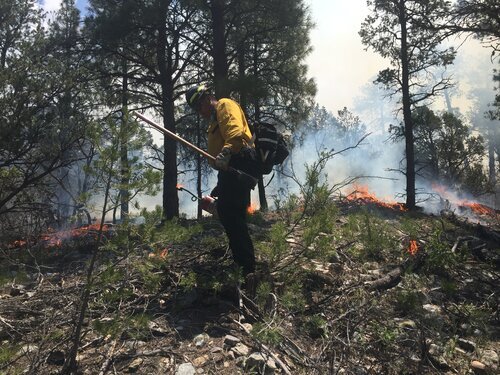
Photo from an All Hands All Lands prescribed burn in 2019

Photo from an All Hands All Lands prescribed burn in 2019

Reduces hazardous fuels, protecting human communities from extreme fires;

  • Minimizes the spread of pest insects and disease;

  • Removes unwanted species that threaten species native to an ecosystem;

  • Provides forage for game;

  • Improves habitat for threatened and endangered species;

  • Recycles nutrients back to the soil; and

  • Promotes the growth of trees, wildflowers, and other plants.

What are the types of prescribed burns?

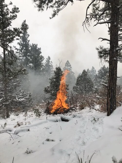
Photo from an All Hands All Lands pile burn in 2021

Photo from an All Hands All Lands pile burn in 2021

Broadcast burning: “Broadcast burning involves fire applied across a predetermined area ranging in size from an acre or less to tens of thousands, generally after an area has not received precipitation for some amount of time to encourage fire movement” (NW Fire Science Consortium)

  • Understory burning: “A prescribed fire ignited under the forest canopy that focuses on the consumption of surface fuels but not the overstory vegetation. Underburning is generally used following a pre-treatment such as thinning and /or pile burning to further reduce the surface fuels, help maintain the desired vegetation conditions and enhance the overall health and resiliency of the stand.” (Bureau of Land Management)

  • Pile burning: “A prescribed fire used to ignite hand or machine piles of cut vegetation resulting from vegetation or fuel management activities. Piles are generally burned during the wet season to reduce damage to the residual trees and to confine the fire to the footprint of the pile. Pile burning allows time for the vegetative material to dry out and will produce less overall smoke by burning hot and clean.” (Bureau of Land Management)

  • Jackpot burning: “A modified form of underburn or broadcast burn where the target fuels to be ignited are the concentrations (or jackpots) of vegetative fuel. The result is a mosaic burn pattern. This technique works well when surface fuels loading is very high following vegetation treatments such as juniper encroachment removal used to improve rangeland ecosystems.” (Bureau of Land Management)

  • Cultural burning: Cultural burnings have been performed by aboriginal and indigenous peoples across the world for millennia and are practiced by many tribes today. These burnings can have many different objectives but what sets cultural burnings apart from other prescribed fires it that the cultural burnings and the resources they affect are “pertinent and substantial to their cultural livelihood”. Visit last week’s Wildfire Wednesday blog to learn more!

How are prescribed burns planned?

“Specialists write burn plans for prescribed fires. Burn plans identify – or prescribe – the best conditions under which trees and other plants will burn to get the best results safely. Burn plans consider temperature, humidity, wind, moisture of the vegetation, and conditions for the dispersal of smoke. Prescribed fire specialists compare conditions on the ground to those outlined in burn plans before deciding whether to burn on a given day.” (Forest Service)

Effects of prescribed fires

There are many public concerns regarding prescribed fires, particularly around air quality and wildlife, but the benefits of prescribed fires far outweigh any negative side effects. Click on the resources below to learn more about how prescribed fire effects these areas of concern.

“Prescribed fire can result in significant benefits to ecosystems and society. Examples include improved wildlife habitat, enhanced biodiversity, reduced threat of destructive wildfire, and enhanced ecosystem resilience. Prescribed fire can also come with costs, such as reduced air quality and impacts to fire sensitive species. To plan for appropriate use of prescribed fire, managers need information on the tradeoffs between prescribed fire and wildfire regimes. In this study, we argue that information on tradeoffs should be presented at spatial and temporal scales commensurate with the scales at which these processes occur and that simulation modeling exercises should include some realistic measure of wildfire probability. To that end, we synthesized available scientific literature on relationships between prescribed fire and wildfire regimes, and their associated ecological and societal effects, focusing specifically on simulation modeling studies that consider wildfire probability and empirical and modeling studies that consider prescribed fire and wildfire regimes at spatial and temporal scales beyond individual events.”

Lessons learned from the Southeastern US

Although we typically hear more about wildfires and prescribed burns occurring in the Western US, there are approximately 45,000 wildfires in the Southeastern US each year. From 1998 to 2018, about 70% of all prescribed burns in the United States occurred in the Southeast (Kolden, 2019). To learn more about fire in the Southeast visit the Wildland Fire in the Southeast webpage.

Why is the Southeast so far ahead in their utilization of prescribed burns? While in the Western US the approach of fire suppression was widely practiced, European settlers in the Southeast learned prescribed burning from the indigenous people and integrated that into their own relationship with the land. Prescribed burning, and selective logging, have been culturally accepted by communities in the Southeast and have been a part of land management since its early inhabitance. Learn more about the history of prescribed burning in the Southeast by reading this paper: The Historical Foundations of Prescribed Burning for Wildlife: a Southeastern Perspective.

To learn more about how Western states are learning from Southeastern fire practices check out:

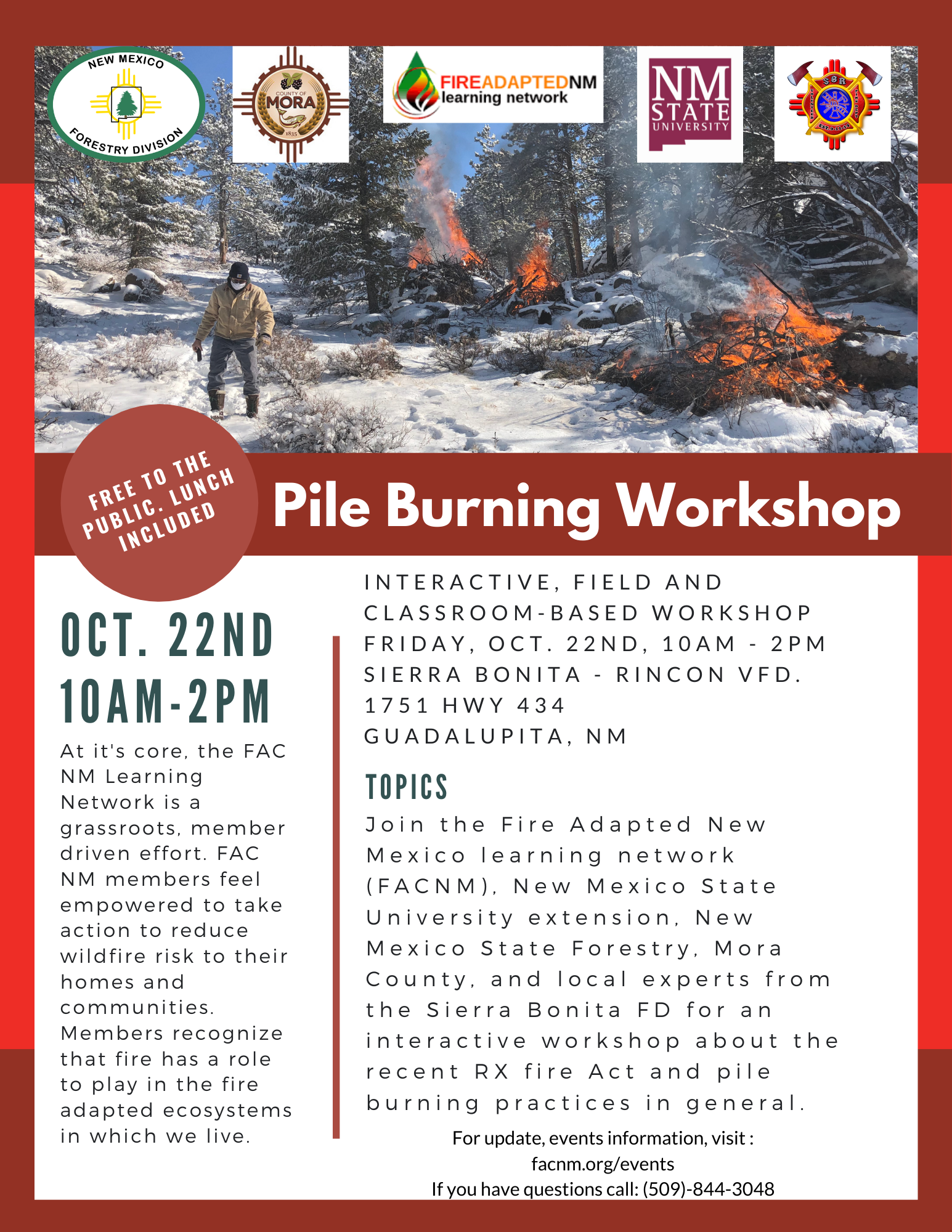
Upcoming Pile Burning Workshop

pile burning wksp..png